Getting there
Park or start from Arrowtown, and follow the Millenium trail up to Tobins bridge and the start of Tobins track. Walk up Tobins track until you come to the bench and view point at the top of the track. The 4wd track continues on around the corner and you'll come to a small junction. Directly ahead of you is the Queenstown Trail sign for the start of the Mt Beetham walk.
Plan & Prepare
This site is loaded with maps, information and advice
Here’s how to get the most out of it:
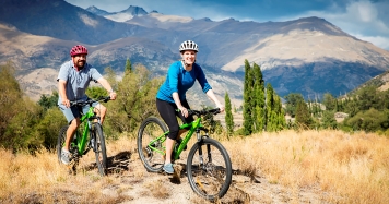
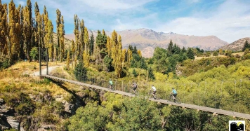
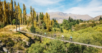
- Choose your ride: You’ll be spoilt for choice – so many options, so many trails.
- Find rides to suit your experience and time frames.
- Plan your adventure: To find local places to eat, stay and discover, check out the directory listings. You’ll find tour operators, transport providers, cafes, wineries and activities and so much more.
- Download a map or the Great Rides app
- Watch the Queenstown Trail video
Some more information on how to prepare for your journey out on the trails can be found here.
Trail code
Here are a few important pointers to foster positive attitudes between different trail users and remember we are lucky that many local landowners have given us access to their private property.
- Share the trail with care and use a bell
- Keep to the left and pass on the right
- Bikers give way to walkers
- Stay in control so you can safely avoid other users and keep yourself safe
- Be patient behind slower riders and pull over where practical to let faster riders pass
- Keep to the trail, don’t trespass on private land
- Horses are generally not permitted on the Queenstown Trail, except for approved shared-use sections
- Dogs should be under control at all times - check out QLDC's rules and regs around dog walking in the district here
- Light no fires
- Report all hazards
- Keep streams and lakes clean
- Bury toilet waste
- Take your rubbish home with you
- Protect plants and animals
Guided options
Many of our Trusted Partners offer guided tours and shuttles to and from the start and end points of the trails - allowing you to ultimately tailor your trail experience and pick up tons of local knowledge and discover secret spots along the way!
Click here to see our Directory of Tour Operators.
FAQ's
Go to the Frequently Asked Questions page to find answers to any questions you may have before you head out onto the trail.
Support us
If you've experienced our trails and loved them, please support us and donation online today. As a registered charity, we rely upon ongoing funding and donations to maintain and extend our trail network. Find out more and donate here.
DONATE